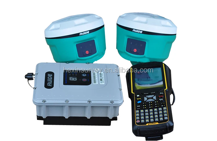
Ruide R6 gps rtk de doble frecuencia equipped with BD970 Mainboard gnss rtk system
Key Features :
• Smallest Size Easy to Carry
• Intelligent platform very smart
• Tilt Survey, E-Bubble, NFC functions are onboard now
• Pacific Crest BD970 GNSS mainboard
• Employs a WiFi Module
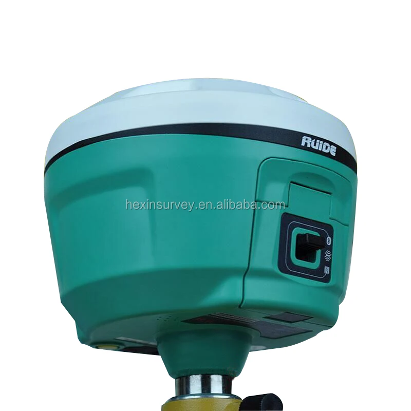
 | Smallest size in industry and innovative design with 12.9cm X 11.2cm. Using Aeronautical material Magnesium alloy with sophisticated industrial design, providing a unique advantage compared to other materials: light weight, resistance to external impact and shock absorption, and good electromagnetic shielding. |
 | Intelligent platform provides an excellent solution for the interaction between the receiver and user, such as power management, voice broadcast, and self-inspection. |
 | The internal tilt sensor helps to survey without leveling the receiver, in order to improve survey efficiency. Tilt angle is allowed up to 30° Built-in tilt compensator corrects the coordinates according to the direction and tilt angle. |
 | The internal electronic bubble sensor can display the leveling status of the receiver on the controller in real time. You don't even need a leveling bubble on the pole anymore.
|
 | Equipped with Bluetooth 4.0 module, which supports receiver to work seamlessly with smart phone, tablet from Bluetooth 2.1 to 4.0 and also making Bluetooth communication faster and more stable. NFC is also available for fast connection. |
 | Pacific Crest BD970 GNSS mainboard board is a compact multi-constellation receiver designed to deliver centimeter accuracy to a variety of applications. That enables NOVA R6 to support a wide range of satellite signals, including GPS L2C and L5, GLONASS L1/L2 signals, and also Galileo and BEIDOU signals for improving accuracy and speed of positioning. |
 | Integrated with powerful data-link system, NOVA R6 is compatible with current radio protocols in the market from 410-470MHz, supporting all kinds of network types to access CORS seamlessly. The protocol can switch between TRIMTALK protocol and SOUTH protocol as needed. |
 | NOVA R6 employs a WiFi module, which enables PC and cell phone to connect to the receiver and read the survey data directly through the software. |


SPECIFICATION | |
Surveying performance | |
Channel | 220channels |
Signal Tracking | BDS B1, B2, B3 |
GPS L1C/A, L1P, L2C/A, L2P, L3 | |
GLONASS L1C/A, L1P, L2C/A, L2P, L3 | |
SBAS L1C/A, L5 (only for the statellites supporting L5) | |
Galileo GIOVE-A, GIOVE-B, E1, E5A, E5B | |
QZSS, WAAS, MSAS, EGNOS, GAGAN, SBAS | |
GNSS Features | Positioning output rate : 1Hz~50Hz |
Initialization time : <10s | |
Initialization reliability : >99.99% | |
Positioning Precision | |
Code Differential GNSS Positioning | Horizontal: ±0.25 m + 1 ppm |
Vertical: ±0.50 m + 1ppm | |
SBAS positioning accuracy : typically< 5m 3DRMS | |
Static GNSS Surveying | Horizontal: ±2.5 mm + 0.5 ppm |
Vertical: ±5 mm + 0.5 ppm | |
Real-Time Kinematic Surveying | Horizontal: ±8 mm + 1 ppm |
(Baseline<30s) | Vertical: ±15 mm + 1 ppm |
Network RTK | Horizontal: ±8mm + 0.5ppm |
Vertical: ±15mm + 0.5ppm | |
RTK intialization time: 2~8s | |
Phycical | |
Dimension | 12.9cmx11.2cm |
Weight | 970g(including installed battery) |
Material | Magnesium aluminum alloy shell |
Environmental | |
Operating | -45°C ~ +60°C |
Storage | -55°C ~ +85°C |
Humidity | Non-condensing |
Waterproof/Dustproof | IP67 standard,protected from long time immersion to depth of 1m |
IP67 standard,fully protected against blowing dust | |
Shock and vibration | OFF Status:Withstand 2 meters pole drop onto |
ON Status:Withstand 40G 10 milliseconds | |
Electrical | |
Power Consumption | 2W |
Battery | Rechargeable, removable Lithium-ion battery |
Battery life | Single battery: 7h(static mode) |
5h(internal UHF base mode) | |
6h(rover mode) | |
Communications and Data Storage | |
I/O Port | 5PIN LEMO external power port + RS232 |
7PIN LEMO RS232 + USB | |
1 network/radio data link antenna port | |
SIM card slot | |
Wireless Modem | Integrated internal radio receiver and transmitter 0.5W/1W |
External radio transmitter 5W/25W | |
Working frequency | 410-470MHZ |
Communication protocol | TrimMark3,PCC EOT,SOUTH |
Cellular Mobile Network | WCDMA 3.5G module,GPRS/EDGE |
Double Module Bluetooth | BLEBluetooth 4.0 standard,supports connection with Android and IOS |
Bluetooth 2.1+EDR standard | |
Data Storage/Transmission | 4GB internal storage,more than 3 year's raw observation data (about 1.4M/day), |
based on recording from 14 satellites plug and play mode of USB data transmission. | |
Data Format | Differential: CMR+,CMR×,RTCM2.1,RTCM2.3, |
GPS OUTPUT: NMEA0183,PJK plane coordinates,binary code | |
Network module support: VRS,FKP,MAC,supporting NTRIP protocol | |
Inertial Sensing System | |
Tilt Survey | Built-in tilt compensator ,correcting coordinates automatically according to the tilt direction and angle of the centering rod |
Electronic Bubble | Controller software display electronic bubble,checking leveling status of the centering rod real time |
User Interaction | |
Buttons | One-button operation,visual operation |
1.Any inquiries will be replied within 12 hours.
2.All our products have one year warranty, And we sure the products will be free from maintenance within warranty period.
3.All products will have been strictly quality checked in factory before sending out.
Packing
We have strong cooperation with DHL, TNT, UPS, FEDEX, EMS,China Air Post.
You can also choose your own shipping forwarder.
Generally, we accept Trade Assurance, Irrevocable LC at sight, Advance T/T, Paypal, Escrow and West union.If you prefer other payment terms, please let us know.


